FINAL DELIVERABLE APPROACHING
Out for delivery. The package is on its last leg.
Mission 32BF
MissionBrief

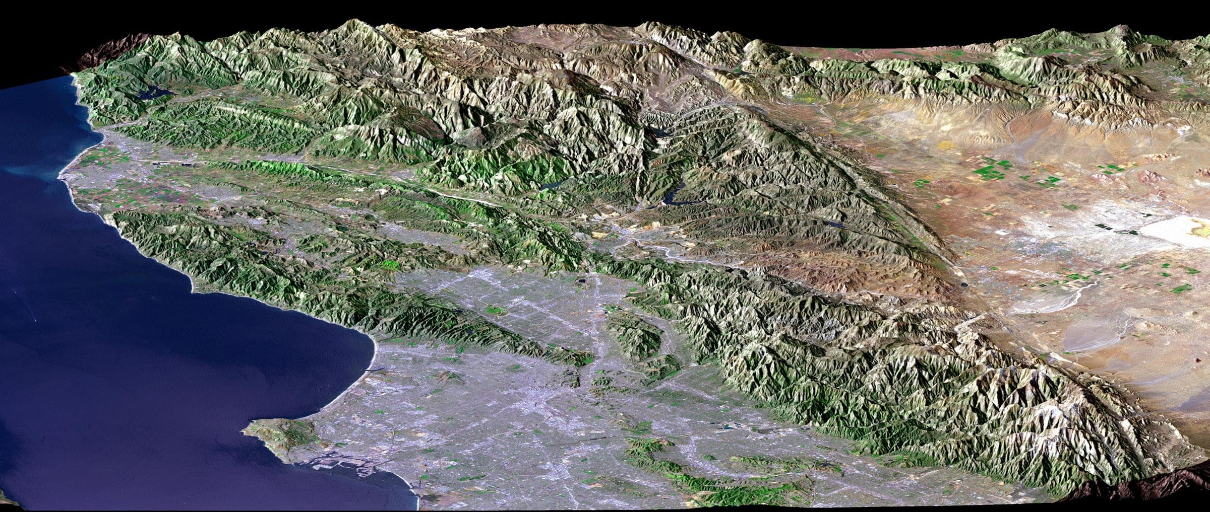
Archive frame — not this capture
LANDSAT + SRTM · LOS ANGELES, UNITED STATES · 04.05.2001
Sequence of events
Mission timeline
7 of 9 stages complete. A stage that has been reached carries the time it was reached at; a stage still ahead carries the condition that opens it, and never a date this file does not hold.
MISSION CONFIRMED
16:11PM 03.08.2026Order received. Target coordinates locked and queued for tasking.
Log entry16:08PM 03.08.2026ORDER RECEIVED
Target accepted: LOS ANGELES, CA / US. 50 × 70 CM framed. Awaiting payment authorisation.
SATELLITE TASKED
11:24AM 05.08.2026Collection request accepted by the constellation operator.
CAPTURE WINDOW
09:40AM 10.08.2026Satellite passes scheduled over the target. Awaiting clear conditions.
IMAGE ACQUIRED
18:42PM 15.08.2026Frame captured and downlinked. Preview released to this file.
PROCESSING
10:05AM 16.08.2026Colour grade, composition and telemetry overlay applied.
PRINT
14:30PM 17.08.2026Print file released to the production facility.
SHIPPED
21:15PM 20.08.2026Package handed to the carrier. Tracking active.
FINAL DELIVERABLE APPROACHING
06:20AM 24.08.2026IN STAGE 56D 01HOut for delivery. Final deliverable approaching your address.
DELIVERED
Closes the file on hand-off.
Instrumentation
Conditions and orbit
The two live instruments on the file. Both read the same telemetry the timeline reads and neither predicts anything the record does not already hold.
Conditions at capture
At capture · 18:42PM 15.08.2026
Cloud cover
2 %
Sun elevation
63.7°
Azimuth 135° SE · solar time 10:44
Wind and sight
- Ground wind
- 4.6 m/s
- Wind from
- 244° WSW
- Visibility
- 20.4 km
Air
- Air temperature
- 27.1 °C
- Dew point
- 18.0 °C
- Humidity
- 58 %
- Pressure
- 1010 hPa
Unobstructed sky over the target.
Cloud cover is read from the mission record. Solar geometry is computed for the capture time and the target coordinates. The surface fields are modelled from latitude, season and local solar time, pending a weather API reading.
- Inclination
- SSO 97.4°
- Altitude
- 514 km
- Period
- 94.8 min
- Look azimuth
- 117° ESE
- Off-nadir
- 1.3°
- Resolution
- 0.54 m
Altitude is exaggerated ×7, and the view is rolled 53° to the house track. Track offset at capture is 0.105°, taken from the off-nadir look. The ground track is equirectangular, ±180° about the target meridian. It is tracking at one revolution every 26 seconds.The marker is parked at the capture point.
The record
Specification
Everything the file holds. Bars cover house routing metadata only — never your address, your receipt or anything else you are entitled to read at a glance.
Target
Stage
Capture window
Deliverable
- Format
- FMT-5050 × 70 CM · 20 × 28 IN
- Mount
- Framed
- Print region
- US
- Facility
- RENO, NV
- Produced in
- UNITED STATES
Fulfilment
- Tracking
- Held with the ownerUPS
- Estimated
- 24.08.2026
Pass telemetry
- Resolution
- 0.54 mper pixel on the ground
- Sensor
- HR / OPTICAL
- Track
- //ELIPSE 53°
- Inclination
- SSO 97.4°
- Altitude
- 514 km
- Azimuth
- 117°
- Off-nadir
- 1.3°
- Cloud
- 2%
- Downlink
- Operator
File
- Mission
- 32BF
- Short link
- shot.space/M32BF
- Opened
- 16:08PM 03.08.2026
- Captured
- 18:42PM 15.08.2026
- Handling
- Tasking ref
Exhibit A / watermarked preview
The frame
A watermarked, low-resolution reference for the file. The wall behind it is the same capture in monochrome; the print keeps its colour, because colour is what prints. The deliverable is the printed object: 50 × 70 CM / 20 × 28 IN, framed, produced in the United States.
Overhead
The sky over this target
WorldView-3
Maxar · NORAD 40115
- Sub-point
- 33.01° S 138.33° W
- Altitude
- 626 km
- Speed
- 7.54 km/s
- Inclination
- 97.85°
- Period
- 97.0 min
- Resolution
- 31 cm panchromatic
Rises over the target in 10 h 26 min · peak 67°
Sub-metre optical imager. The sharpest commercial optical sensor in orbit.
Commercial tasking · elements 9.6 h oldPléiades Neo 3
Airbus · NORAD 48268
- Sub-point
- 41.72° N 43.56° E
- Altitude
- 629 km
- Speed
- 7.55 km/s
- Inclination
- 97.89°
- Period
- 97.2 min
- Resolution
- 30 cm panchromatic
Rises over the target in 9 h 43 min · peak 20°
Very-high-resolution optical imager, tasked in short revisit windows.
Commercial tasking · elements 8.7 h oldCartosat-3
ISRO · NORAD 44804
- Sub-point
- 37.13° N 28.90° E
- Altitude
- 509 km
- Speed
- 7.62 km/s
- Inclination
- 97.42°
- Period
- 94.8 min
- Resolution
- 25 cm panchromatic
Rises over the target in 9 h 26 min · peak 51°
High-resolution cartographic imager.
Commercial tasking · elements 8.5 h oldGeoEye-1
Maxar · NORAD 33331
- Sub-point
- 65.75° S 125.71° W
- Altitude
- 704 km
- Speed
- 7.50 km/s
- Inclination
- 98.12°
- Period
- 98.3 min
- Resolution
- 41 cm panchromatic
Rises over the target in 10 h 44 min · peak 72°
Long-serving sub-metre optical imager.
Commercial tasking · elements 9.5 h oldSkySat-C11
Planet · NORAD 42987
- Sub-point
- 15.47° S 59.43° W
- Altitude
- 379 km
- Speed
- 7.68 km/s
- Inclination
- 97.45°
- Period
- 92.0 min
- Resolution
- 50 cm panchromatic
Rises over the target in 3 h 14 min · peak 56°
One of a smallsat constellation flown for rapid revisit.
Commercial tasking · elements 10.7 h oldLandsat 9
NASA / USGS · NORAD 49260
- Sub-point
- 77.74° S 106.53° W
- Altitude
- 731 km
- Speed
- 7.49 km/s
- Inclination
- 98.22°
- Period
- 98.8 min
- Resolution
- 15 m panchromatic
Rises over the target in 9 h 14 min · peak 17°
Open Earth-observation record. The example frames on this site are Landsat.
Open data · elements 9.5 h oldSentinel-2C
ESA Copernicus · NORAD 60989
- Sub-point
- 14.27° S 34.33° E
- Altitude
- 795 km
- Speed
- 7.46 km/s
- Inclination
- 98.57°
- Period
- 100.6 min
- Resolution
- 10 m multispectral
Rises over the target in 9 h 47 min · peak 27°
Open multispectral survey on a five-day global revisit.
Open data · elements 9.3 h oldTerra
NASA · NORAD 25994
- Sub-point
- 20.45° S 5.09° E
- Altitude
- 696 km
- Speed
- 7.51 km/s
- Inclination
- 97.93°
- Period
- 98.6 min
- Resolution
- 15 m (ASTER VNIR)
Rises over the target in 7 h 55 min · peak 25°
Flying since 1999. The long baseline every newer sensor is compared against.
Open data · elements 10.0 h old
Orbital elements published by Orbital elements, fetched directly and refreshed every three hours. Positions are SGP4 propagations of those elements, computed in your browser, not telemetry: no one is downlinking to this page. The oldest element set shown was fitted 10.7 h ago, and accuracy degrades as that age grows.
Distinctions
Digital only
Held on this file · nothing is posted
Five distinctions are conferred on every mission, and mission 32BF holds all five. They are honorary and they are digital: each one is a badge held on this file and shown with it, exactly as the telemetry above is held and shown. None of them is manufactured, packed or posted — the print is the only object that arrives. None is scarce, competitive or held back for a result, nobody awards them, and there is nothing to win.
All five are named on the certificate issued with the order, which is written for the kind of mission it records: a commission certificate where a satellite was tasked for a new frame, an archive certificate where an existing frame was printed.
 Digital badge32BF
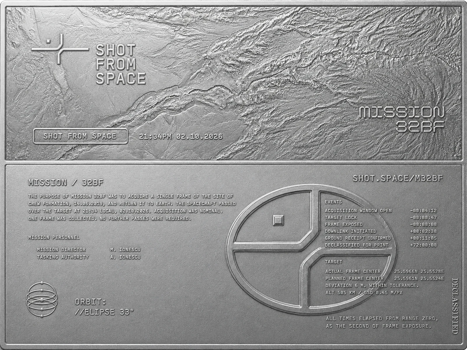
Mission plate
The whole file drawn as a single struck sheet — the frame embossed above, the record embossed below, in the same arrangement the print uses. It is the file shown as an object rather than as a page, and it is the badge that carries the most of the record.
- Form
- Digital badge
- Conferred
- Every mission
- Render depicts
- Struck aluminium
 Digital badge32BF
Mission patch
The mission’s own insignia, drawn as embroidered twill. It is conferred the moment the mission is confirmed and it stays on the file for as long as the file exists.
- Form
- Digital badge
- Conferred
- Every mission
- Render depicts
- Embroidered twill
 Digital badge32BF
Mission badge
A medallion rendered in brushed aluminium, the mark raised at the centre and the mission legend drawn around the rim. It marks a mission that reached a confirmed frame rather than one that was merely opened.
- Form
- Digital badge
- Conferred
- Every mission
- Render depicts
- Brushed aluminium
 Digital badge32BF
Mission coin
Rendered as struck bronze, the mark raised at the centre and the mission legend around the rim. One per mission, conferred whether the first pass clears or the mission is re-tasked four times.
- Form
- Digital badge
- Conferred
- Every mission
- Render depicts
- Struck bronze
 Digital badge32BF
Lapel pin
The mark itself, drawn at the scale a lapel pin is made to and finished as hard enamel — the same mark that stands raised at the centre of the coin and the badge. Shown as the mark, not as a photograph of a pin.
- Form
- Digital badge
- Conferred
- Every mission
- Render depicts
- Hard enamel
Each is a render, and the render is the distinction. The legend drawn on the coin and the badge reads MISSION B324, and the plate is drawn with a mission code, a capture time, a coordinate pair and two named personnel of its own — all of it specimen text carried in the artwork, none of it this mission’s record. The code stamped on each badge frame is the real one. The record itself is the file you are reading. The pin is represented by the mark it would be enamelled from.
Operator channel
Mission comms
Owner only
File actions
The address, the receipt and the share key are released to the account this mission was filed to. Sign in with that address to open the full file.
Sign in to open the file