MISSION 30US
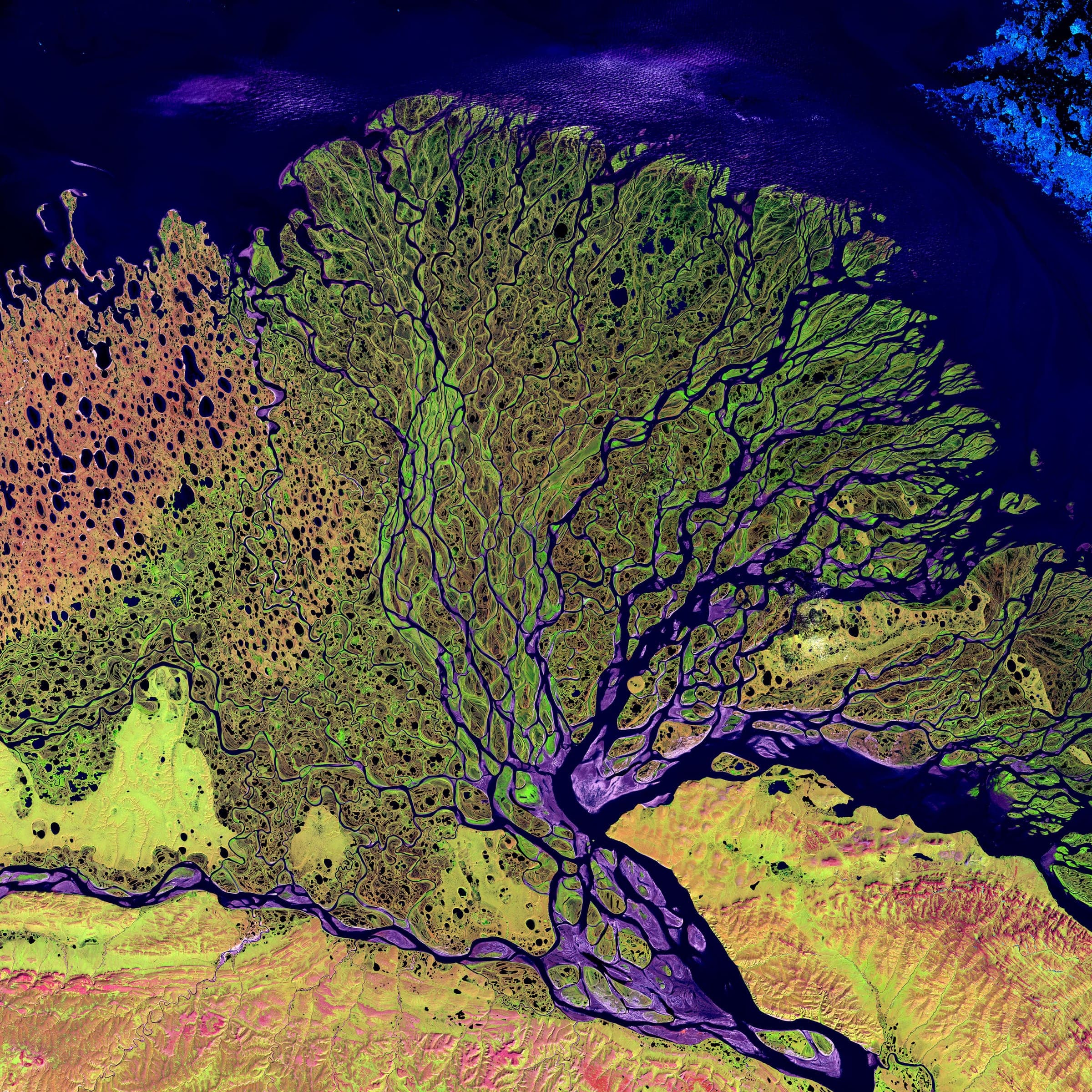
Lena Delta, Russian Federation
LANDSAT-7 / ETM+ · DECLASSIFIED
Frame detail
MAG ×1.75 — 30 M GSDObservation
What the pass recorded.
The Lena delta discharging into the Laptev Sea — a fan of channels and thaw lakes roughly 400 kilometres across, and one of the largest protected wetlands in the Arctic. The braided pattern is meltwater, frozen for most of the year and resolved here during the short northern summer.
Telemetry
As flown.
The pass that produced the frame above, as it was recorded: where the sensor was, what it was pointed at and what the sky was doing at the moment of capture.
- Coordinates
- 72.5000, 126.5000
- Position
- 72.50° N / 126.50° E
- City
- Lena Delta
- Admin area
- Sakha
- Country
- Russian Federation
- Captured
- 27.02.2000
- Sensor
- LANDSAT-7 / ETM+
- Altitude
- 705 km
- Ground sample
- 30 m
- Pass azimuth
- 141°
- Off-nadir
- 8.6°
- Cloud cover
- 1%
Composed by the same pipeline that produces the print file: the capture above, the mission sheet below. Shown watermarked, at preview resolution, in a display mount.
Deliverable
How it would be printed.
Standard issue. Street grid stays legible.
- Format
- 50 × 70 CM
- Imperial
- 20 × 28 IN
- Ratio
- 5:7
- Finish
- Framed
- Print facility
- US / RENO, NV
Source
This reference frame is a public-domain NASA / USGS Landsat product. It stands in for a customer capture, which is tasked commercially and delivered at higher resolution.
- Credit
- http://visibleearth.nasa.gov/view_detail.php?id=3451 Visible Earth v1 ID: 18024 Credit: Image provided by the USGS EROS Data Center Satellite Systems Branch. This image is part of the ongoing Landsat Earth as Art series. This image was acquired by Landsat 7’s Enhanced Thematic Mapper plus (ETM+) sensor on 2000-02-27 (Visualization Date: 2002-08-19). (The Lena Delta can be found on Landsat 7 WRS Path 131 Row 8/9, center: 72.21, 126.15.)
Tasked across commercial imaging constellations
- PLANET
- VANTOR
- SATELLOGIC
- ICEYE
- UMBRA
- GEOSAT
Set in type, not in marks. The operators above are constellations reachable through our tasking network; none of them is a partner of Shot from Space and none endorses it. Frames shown on this site are reference imagery for positioning, not operator captures — see the imagery credits.

End of file
This frame was already taken. The next one is tasked for you.
Give an address and a satellite is scheduled over it. The frame comes back composed with its own mission sheet, printed on the continent you live on and shipped as a finished object.
Start a missionMissions from €65 · Shipping and duties included · Full refund if no usable frame in 60 days